(older entries, separated by genre or date, are listed at the bottom of this page.)

Thursday, May 31, 2012

Halibut Point State Park and the Beginning of Summer

Other than my Lake Willoughby post (which gets billions of hits), my next most popular post is the one on Halibut Point State Park. When my old roommate Joe graced Massachusetts with a random visit a few weeks ago (he moved to Colorado), we were trying to figure out where to meet for a relaxed hang session. He wanted to show his new lady friend Mariko a nice spot in Mass. I figured, although I wasn't planning on going until much later in the summer, a visit to Halibut Point made a lot of sense to someone who doesn't see a lot of ocean. I drove the hour and a half (the afternoon after I drove to Cambridge and back for a Receiving End of Sirens reunion show) to Rockport, MA and met up with them. 

It looked pretty much the same: glorious. 


If you never read my first post (get on it), Halibut Point State Park is pretty much this: you walk like 1/8 of a mile into the woods and are met with a giant rock quarry surrounded by rocks and a small section of woods, and then the ocean. It's at the most north point of the north shore, so when you stand on the edge, you're at the very tip of Mass, looking towards Maine. You first look at the beauty of a rock quarry with the ocean behind it, then walk to the next view point looking over the ocean from huge rocks, then walk along the ocean. It's awesome and beautiful. 

Joe and Mariko dug it.

Look at this hipster poet scumbag!


Here's Joe taking a picture of Mariko in the quarry- it's fun to walk around/climb around in it.


Unlike my first time here, we walked along the coast a lot too, looking for ocean friends. I've always enjoyed wandering around on rocks, so this ruled.


This is my artsy shot of seaweed.


The ocean was raging too, and splashed us nicely at this spot:


Mariko slipped and slid like 8 feet into a rock crack at one point. Pretty hardcore. Here's the view looking towards the huge pile of rocks you stand on:


Here's a nicely cleaned up shot of the left side of the quarry:


Here's the visitor's center/awesome lighthouse-esque building on the property from the ocean side of the quarry (this is kind of the opposite view from the above picture). I love this shot:


And here's looking west towards most likely the Plum Island area of Newbury. The light reflection freaked out a little bit, but hey, what can you do. I'm pretty psyched all of these shots were taken with my iphone. Yea iphoneography!


We left and drove around a little, trying to find a place Joe said his dad took him when he was a kid. We never really found it, but hung out on a pier with this view for a bit. I really like this area. Growing up on a lake, it's both oddly familiar and interestingly alien to me to drive around ocean towns.


Before we even went to Halibut Point, we walked around Rockport in search of ice cream. It was the first day that really felt like summer, and it felt niiice. 

After, we met up with Naro and Sara at the Amesbury Ale House. They have a lot of weird beers and some pretty awesome food. I hadn't seen Naro and Sara in way too long either, so this was the perfect cap to a great day with old (and new) friends.

________________________________________________

Just a few days before this visit, I was in Maine, playing golf with my parents for Mother's Day. My mom suddenly loves golf, so visiting home is pretty much a guarantee of golf. 


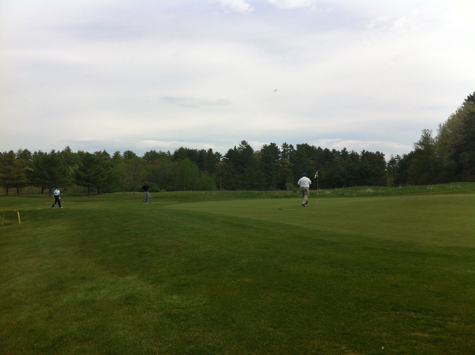
It poured the night before though, and I nearly got a par (of course blew it and got a bogey) on this hole, barefoot. This hole is always wet and I was sick of having my shoes get wetter and wetter, so, after I hit it right in the wettest part (as I always do), I said fuck it and took my shoes off. I've never played golf barefoot, but my chip shot was perfect and I had a nice 2-putt, so maybe I should stick with it. Certainly felt weird though...

I sucked as always, got furious sporadically and was generally extremely inconsistent, but it was nice to be out on the course swinging a stupid club at a stupid ball.

the rents

It started to get real sketchy out there on Mother's Day though- rumbles of thunder and doomclouds on the horizon. Here's a completely ridiculous shot of the clouds through the wonderful world of iphone editing (HDR + Snapseed):


Nice to see the parents, nice to get out on the course in May. Thanks for global warming Al Gore, it's working out nicely for me.

___________________________________________________

And lastly, on this tri-post of mostly photography: after a huge 3 peak hike, then a visit to the parents for golf, then seeing Joe at gorgeous Halibut Point State Park, just 2 days later, I had a day of double barbeques. 

Newer friends Rick and Lisa invited a bunch of people over to their relatively new house for a graduation party for Lisa graduating nursing school. They also got a new dog on the same day. We showed up at about 1 and I stayed until about 7.

Lisa and Mouse the dog


Rick the fireman setting fire to things nobody should set fire to

It was nice- there was a lot of family there that I didn't really speak to at all (except for super offending someone's grandmother), but we hung out outside for 6 hours with solid people, had some freshly grilled food, drank some brewskies, and threw the B. This was the first real B of the year as well as my first BBQ, and it felt fantastic. Winter never really showed this year, but my winter doldrums certainly did. I've been coming out of it nicely by trying to embrace spring with some hiking, but spending the whole day outside just hanging out in beautiful weather felt fantastic. It felt like summer. At last.

soooo green

And what better reason to leave a BBQ then to go to another one? I literally came home, changed my shirt, grabbed some more beers, and headed south to Naro's house for an entirely different BBQ with an entirely different group of friends. It was AWESOME. I recommend this to everyone I know- if you ever have a chance to go to 2 different BBQs in one day, do it. 

I knew everyone here and have for a loooong time, so this BBQ won for the day. Pog and Simone showed up at like 11:30, Mysterio and Masha drove up from CT for it, everyone got to see (and see off) Joe and Mariko (they were leaving the next day), there were like 5 dogs running around, I finally got to see Naro's new house (which is very awesome), and we sat around the fire and ate a 5 pound bag of hotdogs Primus Dan brought while drinking beers, throwing a glow in the dark frisbee, playing Naro's emo collection, and generally having an awesome time until like 3 in the morning.

Bud Light Lime + douchebag mustaches= summer

I ended up literally BBQing/hanging outside with friends for nearly 13 hours that day. I went to bed EXHAUSTED, and I loved it. Not only did I get to see a ton of awesome people, but I really finally felt like summer was here. And my god, that's a wonderful feeling. I hope I can have a lot more days and feelings like this over the next few months. Here's to summer!


currently listening to: We Are The Storm- "To The North Pole"

PS. I know I need to change my layout to a summery one- it will be updated soon.

Wednesday, May 30, 2012

Piper, Belknap and Gunstock Mountains Loop

I'm usually more of a solo hiker. I like to listen to music and go my own speed (i.e. not annoy people/embarrass myself by being painfully slow and taking 3903490 breaks). I also tend to try and talk to people too much while hiking and I just tire myself out even more. But when these 2 morons asked me to go for a hike a few weeks ago, I decided it was time to start hiking with some friends. 


I warned them a lot though, and although Sean assured me he'd go slow and was "out of shape" (haha ok skinny guy), I actually believed Allocca when he said the same thing. 

I proposed doing a loop of Piper, Belknap and Gunstock mountains. Not a huge drive for them, but with decent elevation and mileage to make the trip worth it/make the hike epic. AND, it would enable me to knock 3 more mountains off the Belknap Range list. We met on Carriage Road (off Belknap Mountain Road, off 11A in Gilford), and after some stretching and promises of a long day by me, we headed out to attempt to find the trailhead. 

While we were stretching a car pulled up and joined our line of Nissans, and the guy in the car was pretty much walking alongside us as we started. I asked him if he knew where the trail started, and he said it was up ahead to the right. I said, "alright, I guess we'll just follow you," and thus began the awkwardness of accidentally starting a hike with a stranger. Sean started talking to him while I hung in the back and put headphones on, hoping he'd take off because we were too slow. At my first break, I figured the guy would keep going, but he stayed with us. I guess he was hiking with us now. 

We followed the red blazes on the only trail I saw all the way up. The trail was wetter than I was expecting and a little more immediately steep than I imagined. But it eventually flattened out a little and then starting climbing at a pretty decent slope again, but this time with exposed rocks and the beginnings of views. I was hurting much more than I expected on mountain 1 of 3, and I think it was partly because I was trying to be a part of the group rather than zoning out to music- that, and going faster than I wanted. Sean wasn't sweating and wasn't even breathing hard, and it turns out that the somewhat heavy, I-assumed-he'd-be-slow stranger (Matt) was in great hiking shape. Turns out he hiked all last summer and lost like 60 pounds doing it. He had hiked this before too, so it turned out to be quite good that we met up with him, since the guide we were following didn't help out a whole lot.


Eventually we reached the top of Piper Mountain, and it was pretty nice. 

Looking left/North at Belknap mountain

Looking south towards Crystal Lake

looking straight ahead and HDRed

One ugly crew.

I liked the top of Piper. It was mostly exposed with random trees sprouting everywhere, cairns and configurations of rocks everywhere (one was even a chair- Allocca is in it above), and solid views. This was a new view for me in hiking the Belknaps, and I liked it. There were probably 10 or so people up there too, which was new for me this year, since at most I've seen 1 or 2 on hikes I've done. 

Matt decided to really go for it and headed out towards Whiteface while we sat a little longer and talked to some helpful strangers who told us where to go next. One even gave Sean his number in case he got lost. It's always amazing how nice and helpful people you meet on a mountain can be, especially considering how crappy people often are in the streets. 

After eating some snacks and chugging some water, we headed toward Belknap, following yellow blazes if I remember correctly. We joked that we were so slow that Matt would catch up with us. He did. He did Whiteface FAST. After losing some of our elevation, the trail starting going back up and we got what I would say was easily the best view of the day, and one of the best in all of the Belknaps- a ridge with a bunch of exposed rock, pretty much perfectly in between Piper and Belknap.

God bless you HDR.


If Sean had a blog, this would be his main picture

This view was incredible to me too, because I had hiked 4 days earlier and was excited at budding leaves and what looked like the beginning of summer. It rained pretty much every day in between these hikes, and standing here with this view, I was blown away at how green everything was. 3 days or so of rain sandwiched between 2 hot and sunny days, and boom, it was summer. It was so green and glorious. 

At some point, we turned right onto white blazes instead of continuing to follow yellow (or it was the other way around with the colors... man, I should write these posts less than 3 weeks after I go on these hikes). The sharp right turn immediately took us up, but the trail was significantly more interesting and pretty than the trip up Piper. There was some ridge stuff, and then eventually the trail took us into deeper woods with lots of climbing. Belknap is the highest of these mountains, and I sure was reminded that while wheezing all the way up it.

I lost my group after a surprise break, and headed towards the radio tower at the top of Belknap, running into other people who said they hadn't seen anyone in hours. Uh oh.

Walking back, I found them- they had turned right towards a VISTA (a word I learned on this trip for "view") at a section of exposed rock shortly before the tower. Definitely go that way if you do this hike, since there are some nice views up there.

We sat and had our lunches. Matt ate granola bars, I ate half of a week old sandwich I bought at a gas station on the ride up that wasn't good and made me feel gross (I usually just eat granola bars), Sean had a turkey sandwich that consisted of turkey and bread and nothing else, and Allocca ate freaking spaghetti. "Really? Spaghetti on a hike?" I said. "Hell yea" he said as he set his MRE in the sun to start heating up.
our lunch view


We made it to the top of Belknap and climbed up the radio tower for the high point of this area. While views were obstructed by towers and wires, they were still pretty amazing. It was neat being at the highest point of probably a solid 20 mile radius. We left quickly though, as the wind was pretty insane up there and we were freezing pretty much immediately.


Shortly after starting the trip to Gunstock (which I'm pretty sure was a blue blazed trail), we took a small side trail to another vista, and this one was pretty amazing. We could even see Washington waaaaay in the distance (pretty much in the dead center of this picture). Rich had taken the train up to Washington that day, so I texted him and told him I was looking at him.


The trail we were following crossed over another trail at some point. We followed the one we were on, but Matt said we would actually be coming back to this spot and following the intersecting trail right, to go down to the top of Carriage Road. I'm not sure where the other direction went... It might have been an alternate route to one of the mountains...

Eventually we came to a clearing with picnic tables and 2 small monuments, telling me we were very close to reaching our third peak. 


With one last steep pitch, we were on top of Gunstock. Being on top of ski mountains in the summer isn't rare for me, as I hiked Tecumseh last summer, but it's still a neat feeling. We walked over to the lodge to sit down and get the highest view we could. Seeing houses and Gunstock buildings after seeing nothing but trees and lakes before made this the worst of the three views, but as you can see, it was still pretty nice. Look at those weird clouds too! That was pretty much it for clouds that day.


We stopped and posed for some horrible pictures too. This was the best and worst. From left to right, Allocca, me, Matt the stranger, Sean.

2 people who work at apple, and I'm the one wearing the apple shirt

My feet and back killed, but I was pretty high on the fact that we had mostly accomplished the goal, so I was excited to get back and call it a successful day. About 20 minutes in, we had to stop and wait for about 20 minutes while Allocca held back puke.


He didn't know if he had to throw up, he just knew he didn't feel good at all. I wonder if it was eating hot spaghetti while hiking 3 mountains on a nearly cloudless 70 degree day? Hmm....

He was eventually ok, and we headed down, turning right at the trail we had intersected earlier. It had some nice views through the still budding trees.


Shortly after this picture was taken, Allocca wiped out hard on some wet rock. He had a wet butt the rest of the trip.


It was glorious- I wish I had somehow been taking a picture when it happened, because I saw the whole thing, and his body was completely horizontal in the air at one point. It was AWESOME.

In hindsight, part of me wished we had followed the guide and done the mountains in the opposite order from how we did them. This trail was much more rocky and interesting than the hike up Piper, including sections of stairs. 


However, the trail brought us out to this building and eventually a very long walk down a very boring road (the upper part of Carriage Road). Some people park up here, but I believe the gate closes at 6, and either way, unless you park 1 car at the start of the red trail up Piper and one here, you're going to have to either walk up or down this road. I'll always prefer down, especially since it was pretty steep, and nothing is worse than climbing up a steep hill with no woods or differentiation. 


Right before our boring walk started, we got one last view that was fairly glorious. The sun was in full swing, a slight breeze was blowing, and I had just put Olafur Arnalds on my ipod, making this view the most sad and epic thing ever. 

Allocca mid-stride is weird looking

We weren't too high up, and a lot of trees were blocking the view, but getting one last blast of beauty on such a nice day really ended the trip well. I couldn't help but notice the older couple sitting with the view and got a little sentimental (damn you Oladur Arnalds). 


We walked down the horrible road and got back to our cars. It was weird seeing Matt off, especially since none of us ever even got his last name. I left it as a "well, maybe I'll see you on another hike someday" and off he drove. I've never done that before- met someone randomly, spent like 5 hours with them and that was it. We shared a bunch of laughs and he was a very nice guy, but that was it. Very odd just having a trail buddy disappear like that, but from what I hear of Appalachian Trail hikers, this is pretty normal in the world of hiking. Oh well. Thanks for your help, Matt. You're now part of my journey to earning my Belknap Range patch, and you'll forever be in our memories. 

Hike time: I didn't pay much attention, but around 4.5-5 hours
Distance: Just about 5 miles from online accounts
Elevation gain: A little over 2,000 feet
Albums listened to: Only Owen- "Ghost Town" and sporadic other things. Too many breaks, too much talking.

currently listening to: Shady Bard- "Trials"

Sunday, May 27, 2012

Mount Rowe

In my conquest to hike all the mountains in the Belknap Range as a way to get stronger and sort of in shape to try and hike 4,000 footers, I hit up Rowe a few weeks ago. Rowe is the northernmost of the range, and for my billions of blog readers, you may remember that I tried to hike it last winter, failing miserably. This time I wasn't stupid though, and started from the parking lot behind Gilford Elementary school, following this guide for trail changes. The entrance to the trail is in the back righthand corner of the parking lot, to the left of a small soccer/multipurpose field. It's basically a dirt road to start. 

It immediately became woods, with a great wooden bridge over marshland. 


To the right was Gunstock and Belknap looming over me. I found it odd that it didn't look at all like I was hiking up a mountain- Rowe looked like a small hill in the woods from where I was standing. 


The trail immediately split, and I went right, following the blue trail, which immediately gained in elevation. 


The trail was fairly boring and wide at first. A guy riding his bike with his dog came down the hill. He said he rode all the way up, with the downhill return being his reward. While I would love the down part, the up part sounded like a really horrible thing to me.


Shortly after a short downhill section and a stream crossing, the trail split, and I followed the yellow trail to the left. This was quite hard to see- I'm not sure if they just haven't cleaned it up yet, or if it's always this subtle, but this is what it looked like:


The trail immediately was pretty much vertical. The guide had warned me, but I was surprised at just how steep it was with little footing. My lungs and pathetic leg muscles weren't ready for this at all. 


Eventually, the steepness became more gradual, as I entered into very thick, pine-forrest like terrain. I always love when thick forrest comes out to huge sections of exposed rock, and this had a few nice spots like that.


I was surprised at how long this hike was taking me, since the guide had nothing about mileage on it (just elevation change). Eventually, I came out to a very obvious grassy path, turning right. 


From here, the trail became more obvious and extremely single track-like. I felt like I should be on my mountain bike, not walking (although if I was on my bike, I'd probably be walking, as I hate biking uphill more than anything). 


Here is Gunstock and Belknap, much closer now:


I ended up on a big section of rock with arrows everywhere, a small cairn and some trail markers in the distance. It looked like this was part of a loop trail to take me to Gunstock, so I turned left (the opposite direction of Gunstock) and continued up.


This led me to more exposed rock and the feeling that I was very close to the top.


I was right. Here is the parking lot to Gunstock, with the shadow of the mountain.


I kept going towards the tower, assuming that if anything could be considered the top of Rowe, it would be that. There was a sign there: 


I took a terrible picture of myself,


and began heading back to where the views were. I came across an older woman wearing shorts and a t-shirt who looked like she was jogging up the mountain. I was freezing wearing the same thing, and she looked like she was about to drop dead. Temperatures had gone down considerably, and I was now being hit with some fairly decent wind. 

This is a small mountain, and I'm guessing it doesn't get hiked a ton. The views weren't anything amazing, but they were still pretty nice, especially to someone who felt like he was going to throw up on the way up (don't eat garlicy pizza before a hike). Here's a panorama that worked better than usual- from left to right- Winnipesaukee in the distance, the Gunstock parking lot, and Belknap and Gunstock mountains. 

(click for bigger)

I liked this view the most: 


Obligatory awkward face picture to prove I was there:


Someone's lost hat, blowing in the wind:

So emo.

On the way down, I realized just how much of a biking trail this trail was. Look at this bench cut!


Don't wander off trail too much here though- there are offshoots everywhere. It's hard to find info about Rowe online, so who knows where the trails go. Rowe was at one time an additional ski mountain though, so a lot of the trails could be part of that. One took me to a ghetto table built onto the side of a tree, 


with this hanging on a tree:

WTF? 

Looks like an eggplant or pepper carved to look like a dead animal. I'm confused and scared. 

I absolutely love this picture even though it's done through HDR trickery. My view was much more bright and less colorful than this, but seeing leaves starting to come through made this hike a lot prettier than I was prepared for.


And here's the view from the top through HDR and Snapseed editing:

yea iphoneography!

It started to get dark on the way down, but I reached the parking lot before it was really that bad. This was my first hike since Whiteface over a month ago, and I feel like even though I had done a few before that, this being the biggest yet, and it felt like truly the start to a summer of hiking. I'm disappointed with my commitment last summer, and have made a new goal to hike at least 20 mountains, with 12 of them being 4,000 footers this year. Secretly, I'd like to do a lot more, but I made the goal a long time ago and I think it's a good start. Listening to the epic sounds of Maybeshewill while the sun went down on me, worried that I was never going to get in good enough shape to do the amount of hiking I want to do without dying, I got a little serious. I stood and admired the marshland, letting the music really drive my thoughts. I started to really believe that this hike was the one to jumpstart me. This was the one to get my summer going. I thought to myself, "this hurt a lot, but you have to start somewhere." And this hike was my start. 

When I got back to the parking lot, relieved I had knocked another mountain off and I would soon be sitting in my car with the windows down blasting sweet music on my drive home, I looked at the ground and saw this, written in chalk directly behind my car. I hadn't seen it before, and smiled at the wonderful irony of it all. 


Hike time: About 2 and a half hours
Breaks: Too many
Albums listened to: 
O Brother- "The Death Of Day" (weird and grungy, but mixed with solid post-rock)
Olafur Arnalds- "...And They Have Escaped The Weight Of Darkness" (absolutely              
heartbreakingly beautiful- perfect for the top of a mountain)
Maybeshewill- "I Was Here For A Moment, Then I Was Gone" (gorgeous and grand, especially towards the end. It ended my hike perfectly)

currently listening to- Panic At The Disco- "Vices And Virtues"