(older entries, separated by genre or date, are listed at the bottom of this page.)

Wednesday, May 28, 2014

Mount Willard

In typical Mike mode, I had planned on hiking a 4,000 footer on the way to Lakerage- Mount Cabot specifically since it's super north and has a gate that closes at dusk. I figured it would be perfect to get up there early, slay a 4,000 footer, then arrive (for once) nice and early to Lakerage on Friday night. Well, maybe this year. As per usual, I didn't get my shit together, then really didn't want to get up at 7am the day before Lakerage. So I decided to hike a smaller mountain I was sure would have phenomenal views- Mount Willard.

Mount Willard is accessed from the same trailhead as Tom, Field and Avalon right in heart of Crawford Notch. It's a small hike right in the heart of tourist country with phenomenal views. Actually, if you haven't hiked it but have driven into Crawford Notch, the top of Willard is that cliff you see right in front of you as you start driving up the hill with the Webster Cliffs on your right. I always wondered if there was a trail going to that cliff. Well, this is it.

There's really only one sign you need to see, and it's right at the beginning.


The trail goes through a stream crossing and some turns, but eventually becomes a steady hill.


At one point, there's a small waterfall/cascades area that's nice.


I thought this was pretty odd- there are like 8 of these going through the trail:


That was the most broken through, but there were more of them in various levels of exposure. I have no idea what these could be from, but I'm too lazy to really look into it. Anyone reading this who knows- why are there giant pipes underground on a trail to a small mountain nowhere near ski trails??

I was in good hiking shape by now, but this trail is pretty easy the whole way. It's got some elevation gain in the beginning, but it eventually settles into a very tame slope, on a mostly straight trail with good footing.


These are the kinds of trails I can get down with.


And soon enough, after 1.6 miles of reasonable hiking, I was at the top.


And the view absolutely ruled. Here's my panorama: 


Looking down, it really was quite the cliff. 


To the left was Webster, which, despite what this HDR would tell you, wasn't on fire.


In the middle was 302 and the train tracks for the train that takes you up Washington (at least I'm pretty sure):


To the right was Willey:


It was awesome to be up there and know that I had conquered all the nearby mountains. One day I'll have that feeling for most of the White Mountains (at least the 4,000 footers). That day is far away, but it will happen.

The trail can fool you- it looks like it keeps going, and it basically does, but it just takes you to more mini view points that are just slight variations of the same view. I tried to find if there was an actual summit of Willard, since it seemed like there was more elevation past this point, but I didn't really find it. And besides, this view was why I hiked here. 


As per usual, I hung out too long on top, and didn't get to my car until it was almost pitch black dark. I then headed to a few gas stations to stock up on hot dogs and chips for the Lakerage weekend, and eventually got there, probably around 9 or so. 

Mount Willard is long enough (3.2 miles) that it's not a completely beginner hike, but it's generally pretty easy (about 1,000 feet of elevation gain over 1.6 miles) and I'd recommend it to anyone. The area up top is small, so I'd suggest not going on a tourist weekend, but if you have a day off and get somewhere up north early, this is absolutely worth the trip. The views rule and the hike won't kill you. I'm 100% hiking this again this year, but in the fall this time. YEA FOLIAGE?!! 

currently listening to: Weezer- B-sides

Thursday, May 15, 2014

Son of Saco River Summer Brodown: The Bastard Child Camp Long Lake

With the 3rd year in a row we've gotten a crew together to hit up the Saco River, it's officially become a yearly thing I don't see ending any time soon.

Year 1 was a quieter, colder test run of sorts.


Year 2, we added 2 people and experienced it correctly for the first time (drunk).


Year 3 came about after a week of endless rain. We were granted a nice weekend forecast, and headed out, with 2 new dudes added to the crew- Buote and Ahadi.

The first picture I took told me bringing Ahadi was a good idea. 


We threw all our stuff into 3 cars and met at Saco Bound, thankfully around the same time, with nobody being left at Dunks for 40 minutes. We noticed there were a lot less people than expected. 
Walking in, there was a weird vibe. All I heard was how deep the water was, that there weren't a lot of sandbars to camp on, etc. I went up to talk to the guy and found out right away that this was not looking like a good year for a trip. 
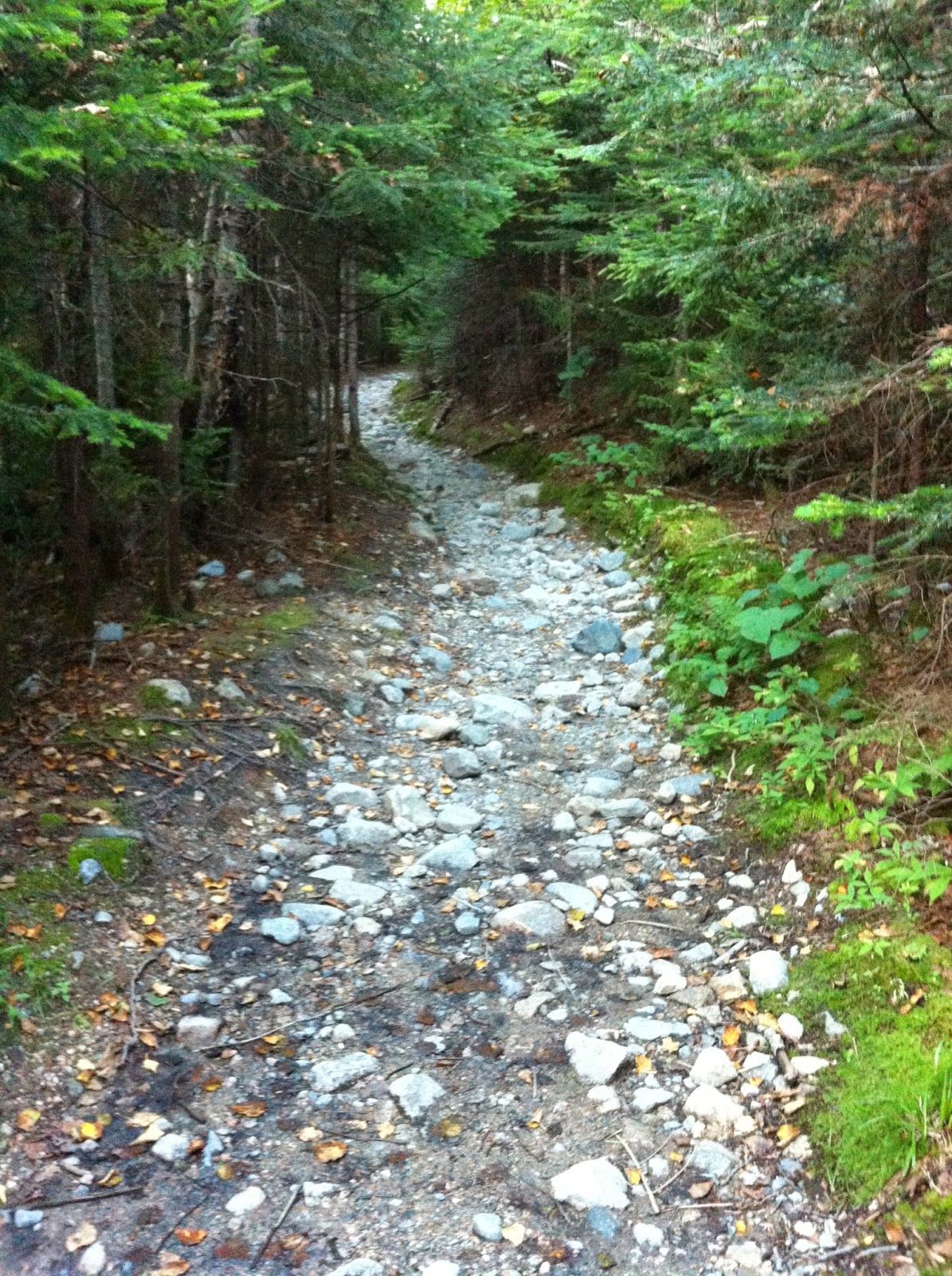
Because of how much it had rained, all the water pretty much comes down the mountains and joins the river. I've known since I started going to the Saco River that an inch or 2 of rain can make the river rise up a foot. The guy told me that they weren't taking people out at some spots (meaning we couldn't do our planned trip), there were barely any sandbars left and we'd have to camp in the woods, there'd be cops patrolling the river to make sure people were safe, and a lot of people had cancelled their reservations. The river had risen a lot- I feel like it was 8 feet, but I may be way off. Still though- a way longer or way shorter trip, camping in mosquito land, waaaay deeper river, no sandbars to stop at, cops everywhere, and thousands of drunk morons we can high five and drunk sorority girls we can creep out would be missing. 
"So... I guess we're not doing this?" 

We took a vote and I think only 2 people were still up for it. An idea was hatched immediately though- we had already put in money, we had already made the drive, we'd already packed, and we had a wide open weekend. Where could we go to drink all the beer and nips we had?

Dave and Ahadi got on the horn calling a few campsites we knew, and everyone was booked. Then Ahadi said we should camp on Long Lake in Maine, where he used to go with his family growing up. It was an hour away (and literally like 15 minutes from where I grew up), it would probably be packed, but we had to go somewhere. So we called it. They had spots available. I guess we were camping on Long Lake.

Since I'm writing this 10 months after it happened, it's funny that our trip to Walmart to get a few things we needed stands out as a big memory in my mind. It was hilarious. 10 dudes who suddenly didn't have to be in a canoe and could carry more just buying so much random stuff. So many extra snacks, a plastic washers game, a giant float, several crappy tiny floats, other dumb toys. We were there forever too. 

When we eventually got to the site, Ahadi and I went in to pay, and I was sooo worried right off the bat. There were families everywhere, and even with 3 spots, we had a pretty small amount of space to get the level of rowdy we were hoping for. But we made it work great (1 site for cars, 1 for tents, 1 for grill/food/hanging out), and we immediately settled in.


And immediately started drinking.

soooooo many nips


And immediately started setting things on fire.


So when we got there, the people who had the spot before us were still cleaning up. They left their fire going a bit, and Dave and Buote turned into extremely destructive people who saw a towel hanging on a line and thought "these jerks left their towel behind and a fire. Let's set their towel on fire!!" literally like 10 minutes after these people left. Only it was Josh's towel that he's owned for like 10 years. I think Buote and Dave have since bought him 6-10 new towels. But none were as good as that one. Trip off to a good start!

We sat for awhile.


Then decided it was time to swim.


Swimming was absolutely hilarious. We brought nips with us that we drank in the water, we threw the B and the Waboba, I kept trying to sink Al's float. It was windy and wavy, the water was deeper than I was expecting, there were a lot of people there, but we didn't care. We were there to party. We went back to the camp site for a bit, where I barely remember this picture being taken with Buote:


Then we headed back. This time, several of us were pretty wasted. I think back to that day and wonder how I didn't drown. I was SO hyper- just endless energy, swimming everywhere, holding my breath for long periods of time. At one point, Rich, Josh and I had a King of the Hill battle on a float that I'm still not sure we were even supposed to be on, pushing each other into deep water with barely any time to take a breath, drunk. By the time everyone had left and the beach settled down, I was absolutely exhausted. These few hours were honestly some of the most fun hours of my whole summer. But man, they were risky. Less drinking and swimming in the future maybe. 

It was time for more hanging out at the camp site.

and yawning, eh rich?

At some point Ahadi got pizza from the little camp store, and truthfully, I should have abandoned the Saco River spaghetti and just ordered a whole pizza from the camp store they had. But I'm a man of traditions. 

We just hung hard for the next few hours as it started to get dark, playing lots of beer pong, drinking, smoking, having a blast. I cooked up some Sac River Spaghetti, others cooked burgs and snausages. 

Matt and Dan were way too good.

At some point, Al, Buote, Josh and I ventured around the whole campsite and found the building there was an all-you-can-eat breakfast at the next morning.


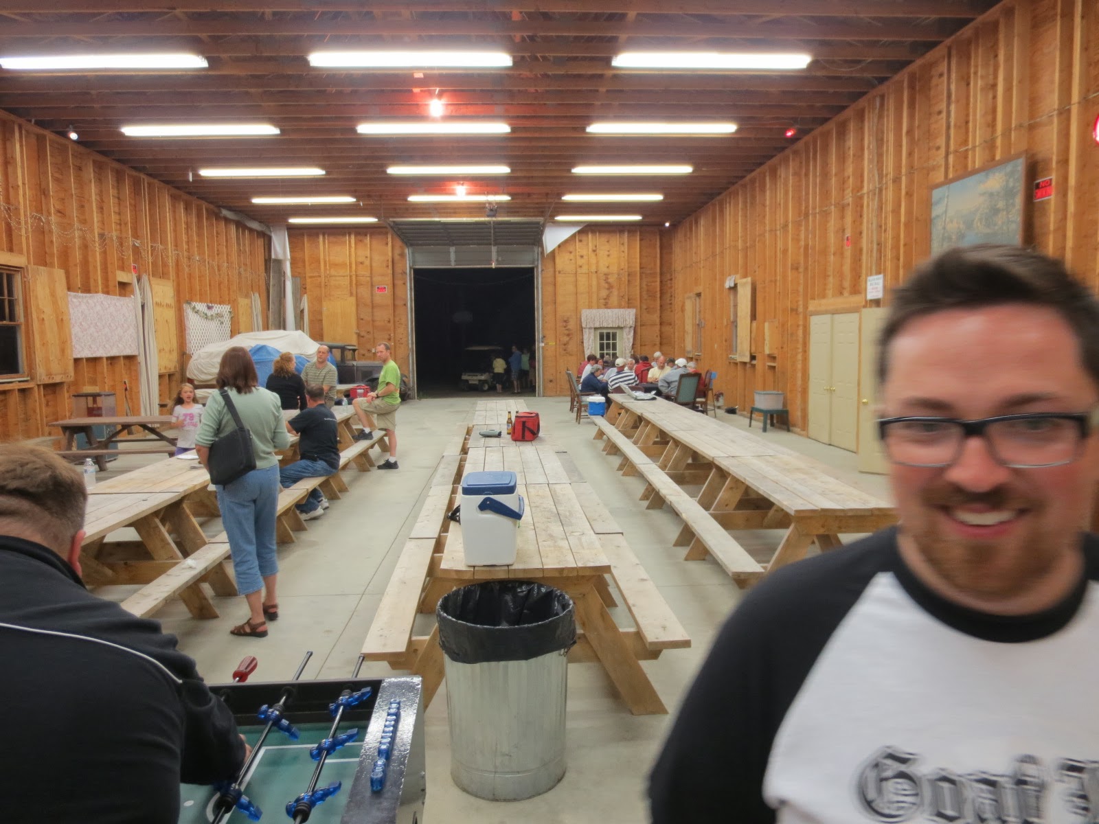
We played some intense games of foosball while Josh picked his nose.

gotcha!

By the time we got back, Dan was showing his normal level of partying:


As people surrendered to a day in the sun with lots of swimming and drinking, us late nighters hung around the fire. And Jesse got real weird.


I started trying to get into my tent and realized I had to go to the bathroom. This is an odd thing to write on my blog, but this was one of the great things about not being on the river- we had actual toilets that weren't outhouses. I'm sure Al, who had explosive diarrhea the whole trip, appreciated this the most. By the time I got back, I could hear lots of snoring, and other than Matt, who was still sitting by the fire (and scared the hell out of me), everyone was out. I could hear other groups talking, but it was mostly quiet. 

I woke up like 4 hours later, freezing and listening to a stupid bird that refused to shut up. Ahhh... the joys of sleeping outside in a tent.

Once it was morning and we finally all collected by the fire, I lost it when I saw Ahadi, looking like a homeless piece of shit, wearing a Megadeth hooded sweatshirt and one of those silver survival blankets.


As I took more pictures, I didn't think I could capture his piece-of-shit-ness better. But he kept surprising me.


And then he hit a home run.

most ridiculous person alive

We ate snacks and started to clean up our mess. You wouldn't believe what 10 not-exactly-health-conscious dudes can create when they already pack too much food, then find out they have unlimited space and buy more.


Looks like 50 people moved in for a week.


Buote and Dan finally got out the plastic washers game they got. It didn't work too well.


Then Dan stepped it up hard. While I was taking my tent down, he went and bought 2 breakfast pizzas, both solidifying that I really should have gotten pizza the night before, and making all of our days. It was awesome. I'd never had a breakfast pizza, and goddamn did these hit the spot.


During cleanup, Ahadi found the sandwich he had packed, ravaged by the water from his cooler. Since Josh ate a few bites of his soggy pizza last year, we told Ahadi that he had to eat at least a bite of his mush sandwich. And thus a tradition was born.


We packed up everything and headed to the beach to take a picture of all of us by the lake, keeping with tradition even if there weren't any canoes. I like this pic of Jesse, left behind in a barren campsite once filled with life.


We took the pic then argued about what to do next. Some of us wanted to stay and swim, others wanted to leave here since they were dry and packed up, but were open to swimming somewhere else. Others wanted to go to the pizza barn and leave as soon as possible. Forever leading the GTFO (get the fuck out) crew, Jesse took Al, Dave and the new GTFO All Star Buote to the pizza barn. Lame!

The rest of us adventurers decided to freeze to death at the Kanc, parking forever away.


It was the most packed I've ever seen it.


I probably say this every time I go, but I swear it was also the coldest it's ever been. Why do we keep going back to this place? It physically hurts! Everyone went in accept for Dan. We hung out in the waterfalls, went down a slide, I took video nobody will ever see because I was too lazy to edit it then and my imovie is broken right now and I don't want to deal with it. At one point, we saw a hot chick half in the water while her friend took pictures of her, then she started filming all the people staring at her friend. What an asshole! How are we not supposed to look?!

We then stopped at a spot Ahadi had been to before (I think) right on 16 that we'd all seen a billion times and never eaten at. I don't remember the name of the place, but it was awesome. Route 16 Diner?

but apparently Ahadi was disgusted with me

We all ate way too much. Everything was solid. I rode back with Matt and Ahadi, having some good chats the whole way. When we got back to the nerd compound, I packed up everything into my car and headed home where the horrible job of cleaning up and putting everything away awaited me. Successful trip!

So we didn't get to do the Saco River last year. No drunk canoeing, no jugamos, no Al tipping his canoe, no nips4nips, no drunk college chicks, no high fiving random dudes, no underwear cowboys (well, Rich took on the role briefly while we were packing up), no TIP games while people canoed through, but also no canoeing (more work than you want it to be), no shitting in the woods, and my butt didn't hurt all day from sitting on those awful canoe seats. I think we did a phenomenal job of saving a weekend with this, but it's time for our triumphant return to river madness this summer.

BROS

currently listening to: Scissorfight- "Mantrapping For Sport And Profit"

Wednesday, May 14, 2014

4,000 footer #8: Mount Jackson

Last summer, my last 4,000 footer of the year, which was sadly only my 8th (wow do I have a long way to go), was Mount Jackson, doing the Jackson-Webster loop. 

I always love parking and being able to see exactly where I'm going. It was a beautiful day, and although late as per usual, I headed out.

that's where I'm going

The entrance to the trail was less than glamorous. 


But if I was at all confused, there was my sign.


The hike climbs pretty much right away, and then about .1 into the hike, there is a short .2 mile spur to the Elephant Head lookout point.


It's short enough that I'd say it's worth it. It does add .4 miles to the trip, but the trail isn't hard (and is kind of interesting). And the view is nice.

I was just on that road!

I thought I'd see some sort of Elephant head, but I guess I was standing on the Elephant head. There's a good picture of it here- it totally looks like an elephant's head.

I headed back to the main trail and it got steep fast.


But in another .4 miles or so, there was another extremely short spur to Bugle Cliff, which was basically the same views as Elephant head, but higher up, and therefore better.


Especially in HDR.


The trail then mellowed out a bit, and I found myself very surprised at how much of a mess it was in a lot of places. This trail is insanely popular, and I could see a lot of kids or grandmas having a lot of trouble with the amount of sharp and huge rocks.


Eventually, the trail split. I could go straight to Webster or turn left to go to Jackson first. 


I knew the views on the Webster Cliffs were going to be the best of the trip, and I wanted to end with them. So on to Jackson I went.

I also went this way because an enormous group (like 20 people) of what appeared to be volunteers headed towards Webster and I like being alone. The trail got muddy and disgusting. I saw a few people working on the trail up here. I'm blown away that these people do this.


The trail eventually hit a point of pretty constant rising in fairly constant woods.


Then I saw my first preview of Jackson. I thought I was higher up.

dammit

I was surprised at how much trailwork had been done this high up.


And how helpful someone was.


Things got dry pretty quickly, and my hike turned into rock climbing for a little bit.


Then I knew I was close.


Booyah.


I did my best to get my standard homemade sign picture, but this was the best I could get out of like 10 attempts. It was just waaay too windy up there and I had nowhere good to balance my camera (I really need to get one of those bendy stands).


As usual, online hiking reports drastically undersold the views from up here.

Looking towards Willey, Willard, Tom and Field:


Looking towards the road (these people were moving faaaassst trying to get to a shelter before it was dark):


The presidentials:


I've been talking about manning up and doing a presidential traverse this year (over a few days), and I was surprised at how manageable it looked once I was 4,000 feet up. But at the same time, this picture is zoomed in. This was my actual view:

that's a loooong way

This traverse looked somehow both kind of manageable and absolutely massive and kind of terrifying, and I could only see to Washington. But then again, nobody says it's small. It is like, 20 miles of hiking after all.

This was looking in the opposite direction from Washington:


And this was directly towards Webster, where I was now heading as daylight disappeared.


Here's an HDR I like way better:


I spent too much time on top of Jackson, and knew I had to make great time to Webster, so I made the trip as fast as I could, which was unfortunately not as quick as I would have liked. There were some very steep, rocky sections:


But luckily, after the initial drop, most of the trail was flat and had boards everywhere, making it nice and fast (other than when I zoned out and walked right off the side of one into mud).


It was neat doing this section, because Appalachian Trail hikers kept coming at me, heading towards the same shelter the people I saw on top of Jackson were going to. They were moving so fast, and they STUNK. 

I got to the sign to either go back down or go to the Webster Cliffs, and headed right to the cliffs, as I had heard they rule.


And it very much ruled up there.


The drop in some spots was absolutely terrifying.

shoe for reference

I don't know why this picture is so dark on the left side:


I hung out way too long and took way too many pictures, but sunset up there was phenomenal. Here's looking sort of back towards Jackson:


Looking at the railroad tracks and Willard:


And here's a sweet panorama I put together that stupid Blogger doesn't seem to let me make any bigger:


I loved it up there- it was real scary being on ledges alone at sunset, but man, the views were great, especially being able to look at Willey, Tom and Field and know that I had stood on top of them looking at this mountain. Willard was the last mountain with views on that side to conquer.

As it started to get dark, I hiked as fast as I could, but eventually had to turn on my headlamp and flashlight and slow my pace down a little. I don't really like hiking at night, I just always end up doing it because I'm irresponsible. Usually I don't care that I'm missing the trail, but this time I kind of did, because there was a huge waterfall in one section that I literally couldn't even see. 

I checked out Bugle cliff on the way down to see how everything looked at night. Turns out, it was pretty dark. 


I got out pretty exhausted, and was psyched to have to walk down the road in complete darkness.

NOT

And that was it. #8 down. Great hike in general- the trail was very interesting most of the way up, and other than some super muddy sections, pretty manageable, at least as far as 4,000 footers go. I'm psyched to start killing them off this year. I have set a completely unreasonable goal of being half way through the 4,000 footers by the end of this summer. Woo!


________________________________________________________________________________

The short version:
Jackson is a very popular hike- not only is it the south end of the Presidentials (though not considered a presidential), but it's one of the easier 4,000 footers, and it's right in the heart of Crawford Notch- tourist central. The trail was messier than I thought it would be, but it's super easy to follow and the views from Jackson are pretty awesome. The true gold was the Webster Cliffs though, so if you're just looking for views, I wouldn't even bother with Jackson. But if you do hit it up, make sure you go to Webster too. I hope to do the Webster Cliff trail sometime, which keeps going all along the cliffs you see when you drive into Crawford Notch.
Directions:
-Take 302 west from Conway into Crawford Notch. Park at the Crawford depot, on the left right before the AMC Highland Center, and basically across from Saco Lake. Walk across the street to Saco Lake and walk down the road where you came from. The entrance to the trail is on the left.
-There are signs everywhere you need them.
-Hike time: I don't remember. Probably between 5-6 hours.
-Mileage: 6.9 miles including the spur trips (which are worth it)
-Elevation gain: about 2,500 feet
-Summit Elevation: Jackson: 4,052 feet, Webster: 3,910 feet
-Number of people seen on the hike: The most I've seen, probably over 30 (20 volunteers)
-Number of times I fell: 1 (I think)

currently listening to: Ween- Shinola, Vol. 1