Boy, I need to write these blogs the night of. This feels like ages ago, and it was actually less than 2 weeks. ANYWAY, to complete my journey of hiking all 12 mountains in the Belknap Range and earning my Belknap Range Hiker patch, I needed to do 3 more- Major, Straightback and Anna. I had already done Major a few times, but I wanted to go for a big trip and do all 3 of them at once. Based on some internet research, it looked like there were trails leading from the top of each right to the next one, so I set off a bit later than I should of (4 in the afternoon), but I figured I'd be ok and had a headlamp just in case.
I started at the Mount Major Parking lot (a very obvious lefthand turn off route 11 in Alton), and took the Boulder Loop trail(left side of the parking lot, over the stream), as I always do. The other side is a very boring trail turning into very steep near-rock climbing at the end. I will always choose the trail with more gradual elevation gain, and the trail that's more interesting.
Major starts out pretty boring though. Pretty much just an uphill road with rocks.
A short ways in, I got to see some really nice graffiti- an upside down peace sign smoking weed.
why's it upside down?
If you haven't hiked Major before (who hasn't at this point?), it's pretty much immediate elevation gain, flattening out, gradual elevation gain, then a flat road, then a very steep and fairly sketchy section that I am surprised more people don't get hurt on, considering how many families and little kids hike here.
I love this section though
The tiny pebbles of rocks slowly getting brushed away make for some horribly slippery hiking.
But after all the rocks, the trail turns into a nice walk in the woods
before turning into walking up a decently steep open rock face, to this view:
Here's a super sweaty dude relaxing with the view after coming up the other trail (which again, I think is much steeper, and for some reason is much more popular based on what the internets say):
Here's a super touched up HDR shot from the back part of the open face looking over Winnipesaukee. Major is always a harder hike than I remember- both in length and steepness, but it's still on the easier side and absolutely worth it for the views.
There's no real summit sign (as with most mountains around here), and therefore I just had to follow logic and follow the pretty much road-sized trail off the back of Major to head to my next destination.

I was feeling good. I had made it to the top in just about an hour and since I'd been up here before, I didn't spend much time hanging out on top. My legs were burning and I had some solid sweat going, but I knew I had 2 more mountains ahead of me that I needed to do before it got dark in 3 hours. Oh- and my right elbow was stinging horribly and burning, and my chest was killing. Why? Well, at the very top of the big pitch before the open rock face, I tried to climb over a fallen tree, using roots to balance myself. When I swung my other leg around, the leg I was balancing on got hung up on a root, and I did a full faceplant. My hand and elbow smashed into dirt, and I landed on the right side of my chest, directly on a rock. AWESOME. It hurt a lot, and I was now covered in dirt and bleeding. LET'S DO TWO MORE MOUNTAINS.
Anyway, as I was walking off the back of Major, a woman and her dog (who scared the crap out of me by barking out of nowhere, pretty much before I knew they were that close) came running down past me. I asked her if this was the way to Straightback, and she said to follow the blue/yellow blazes (which you can kind of see in the picture above and below). I hadn't really found this info anywhere online, so as she sprinted past me, I felt good. I know had clarification I was going in the right direction, and confusion at double-colored blazes.
The rock section before the woods was real neat, but eventually, I was in the woods again
and saw this sign. I didn't even realize the Brook Trail to the Major parking lot led all the way here.
The trail was pretty well marked, and at times looked nothing like a trail, so this helped.
Apparently there's a Quarry Spur Trail too? I have no idea where this leads.
Parts of this trail are surprisingly steep.
I began cursing mountains- why did I have to go down that rock face, only to be met with this right after? ahh... the beauty of multiple mountain hikes.
This summit was kind of like Major- although not as open or obvious, I pretty much knew when I was there. It felt great.
the dirt patterns on my right arm make me look jacked
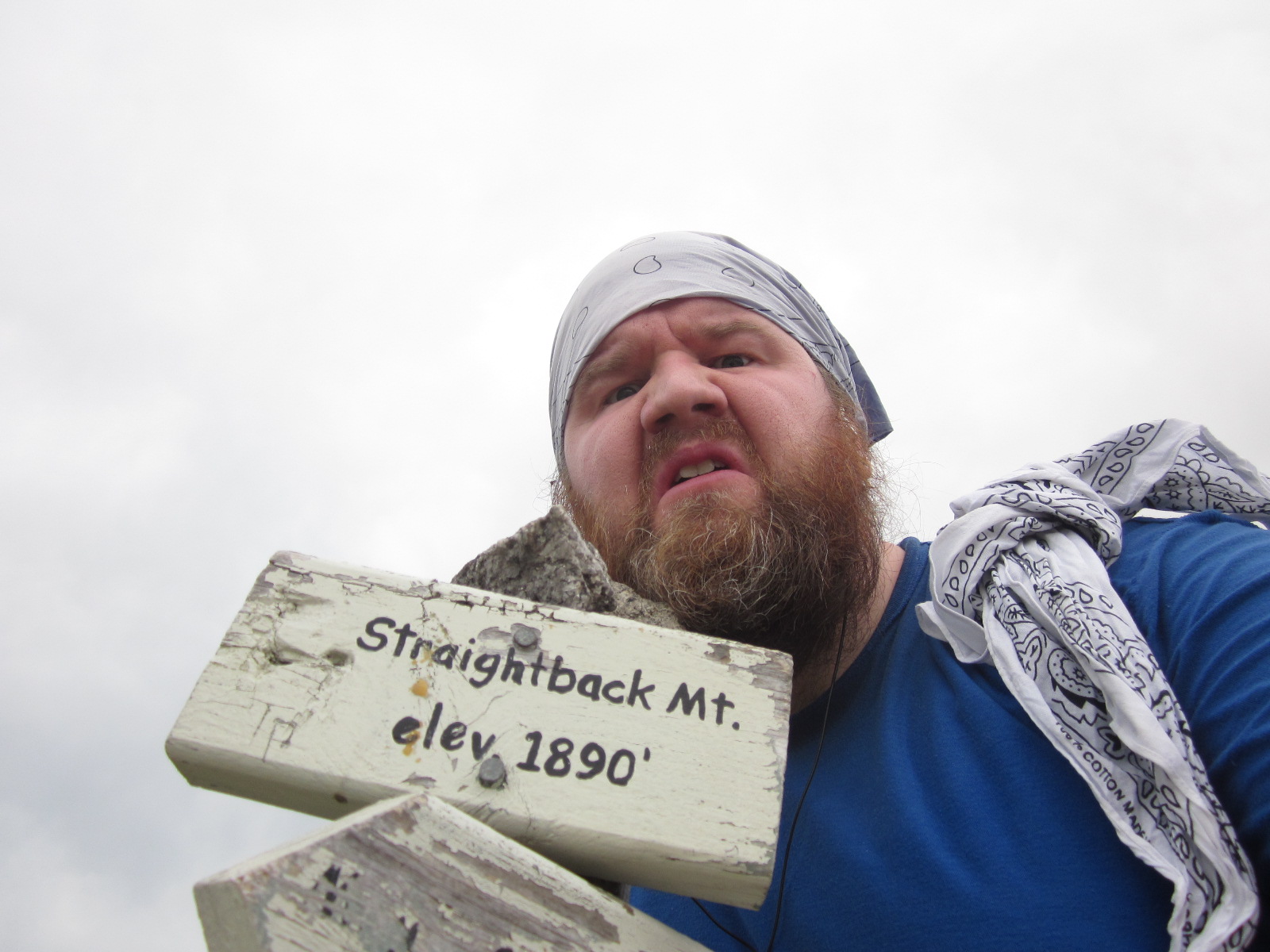
This summit had an awesome sign. I love these things and wonder why every mountain doesn't have one. It's so nice to know exactly where you are and what you have ahead of you.
I mean-mugged by the sign, then sat down for a rest.
I was hurting more than I wanted to be. I had made it to this summit in about an hour too. I had hiked Major in great time, but clearly faster than I should of, since my legs and lungs were starting to hurt more than I wanted them to. And I still had 1.2 to get to Anna.
I really liked the top of Straightback. Views weren't insane, but I could see small lakes on one side and Belknap in the direction I was going. It was a nice mix of exposed rock and small trees and shrubs that were insanely green. There was a decent breeze and the creepy clouds gave me the feeling I love when hiking- that I was completely alone up there. And I was- not only would I guess that people barely hike this mountain, but there were only like 5 people on top of Major, so it was definitely a day of solitude, and a day of me having 2 mountains all to myself.
This was my favorite view- looking towards Belknap and probably Gunstock from the side of the sign:
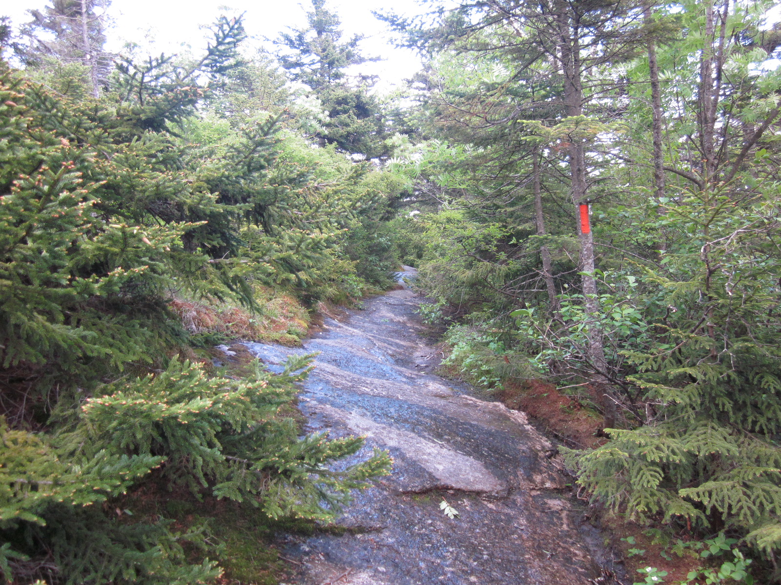
Here's what the trail looked like from Straightback to Anna. It was kind of easy to lose, but luckily, it was marked enough that I was able to find my way back to it if I lost it.
Soon after that, I entered the woods again, and was surprised (as I've been for a lot of my hiking around this area this year) as to just how many lady slippers were EVERYWHERE.
They literally lined the trails, sometimes 15 or 20 of them within a square block of 20 feet. I remember growing up, being told that it was illegal to kill them and never seeing them anywhere. Well, they're alive and well in the Belknap Range.
Does anyone else think they look a lot like something else lady-like other than slippers?
literally just noticed that on this hike.
Once the trail entered the woods, it got woodsy and meant it.
Of course, it also started raining a little bit, and I was of the mindset of "holy crap, if I make good time, I'll get to the summit of Anna at 7, leaving me an hour and a half to do what took me 3 hours to do coming up, before it gets dark. crap crap crap crap," so I didn't enjoy this section as much as I would have normally. But, I was intense. My mind was set to purpose. I had to reach this peak to complete my task, and I had to get there quick. Luckily, not only is the trail like a hidden bike trail and beautiful and meandering through thick woods, it also was pretty reasonable in the elevation gain department. Anna is smaller than Straightback- there was a LOT of elevation loss- so much that I actually began to worry that I wasn't hiking to the top of another mountain, but off the mountains entirely. This severe loss worried me, since I'd have to hike back up all of that on the way back.
But, I eventually got to a clearing, and completed my journey.
I'm just a pile of sweat.
BELKNAP RANGE HIKER
Behind me in the above picture, is a clearing that took me to another cairn with somewhat of a view.
And following a trail behind where the camera was led me to another cairn by a tree marked red (I had been following white). Which one was the summit?
I had no idea. I still haven't been able to find a picture online of what the summit actually looks like. Some blogs talk about following the red trail (some say blue) for a few hundred feet to ledges, but I started to follow it, and after a few hundred feet, I was just much lower than where I started, and further into the woods. The sign I posed next to told me what direction took me to different places, but nothing said that I was at the summit. Was the half-finished broken sign that looked like it had an A and an N on it an old summit sign? I literally have no idea, but it looked like I was at the highest point nearby, or at least on the same level as a lot of neighboring woods, with any trail taking me lower. This, to me, told me that I had to be at the summit.
So, after sitting for way longer than I should have, trying to figure out where ledges were and trying to find a picture of the summit, I finally decided it was time to get going again.
I'm not gonna lie- part of it was that I was listening to
Olafur Arnalds when I got to this point, but I felt a hint of tears in my eyes- that feeling you get where you go "whoa, am I gonna cry?" I can't remember the last time I set out to accomplish something that took a lot of work and achieved it. I'm lazy, and there also haven't been a ton of things I've really wanted. I wanted this. For whatever reason, I really wanted to hike all these mountains and earn that patch, and a feeling of pride and accomplishment absolutely washed over me when I finally felt like I had done it. It was a short journey- only 12 summits spread across a month (other than Whiteface which I did in March), but I had done it. I finished on June 1st, when I said I wanted to finish by June. I had hiked with friends, I had hiked solo. I spent hours researching routes and even more thinking about being out there. I didn't hike perfectly, but I hiked smarter than I have in the past. And I had done it- I had achieved a goal. And It felt awesome.
But oh wait, I was still at least 3 miles from my car and had pretty much an hour before darkness started to set in.
My mood immediately changed when I got to the beginning of the climb back to Straightback Mountain.
I had to dig deep at this point. Temperatures had dropped, and I wasn't breathing as easily. I hurt too- both muscle strain and the beginnings of what always ends up bothering me the most on hikes- my right knee and right heel. I also hadn't brought much food, meaning I was rationing everything drastically. I had only brought 3 shotblocks (not packages, just blocks), half a powerbar, a cliff bar, a snickers bar, and 3 liters of water. I was ok with water, but by the time I made it back to Straightback, I only had the snikers bar left, and that was with me being smart and saving it for a reward- like when I was nearly done and completely out of energy.
I rationed that snickers bar, eating only half of it at the top of Straightback, and let me tell you this- WOW do calories and sugar help drastically when you're nearly done. I instantly felt better, even though it was about a 25% increase in energy when I was at about 10. But it got me farther, and I did my best to enjoy being out there by appreciating some scenery. But it hurt.
This picture wasn't really posed at all. I literally looked like this.
Snickers bars are GLORIOUS when you're that out of energy
The fight from Straightback to Major was epic- an entirely new level of pain and perseverance. It was all about setting goals, resting when I couldn't move anymore (which was often), trying to focus on the music in my ears rather than the pain in my mind, focusing on breathing, and just keeping up the fight. Seeing rocks like these, I began to wonder if they were gravestones for vikings thousands of years ago. And I began wondering if I should lay down next to them and just give up.
I feel like I'm making it out to be more of a struggle and triumph than it was now that I'm writing this, but I can assure you, I'm not exaggerating much. I was in a lot of pain, and on my last bit of energy. Every muscle and joint hurt- every part of me was competing over what could hurt more, and they were all winning. I just kept reaching down and fighting. This was a deep ass pain cave, and I just slowly fought my way out of it. If you've been there, you know. Mind over pain.
Pretty much right as it got dark, I almost ran right into this guy:
porcupine encounter #2!
And as I fought up the last incline to reach Major again, I was now fighting against some solid wind and freezing air. Thank god I finally started hiking a little smarter and at least brought a dumpy old flannel shirt. It saved my life. I couldn't believe how warm it felt and how instantly better off I was once I put it on. This was the view from Major:
I sat in the summits' little rock fort to escape the wind for a bit, ate the last of my snickers, drank nearly the last of my water, tried to calm my heart down, and started the long walk back to the car. It was all downhill from here, and I knew that meant no more climbing, just nonstop pain in the dark.
I put on my headlamp and began the descent, fighting my way through bugs and pollen everywhere, trying to ignore the pain in my heel, my knee, my shoulders, everything. My skinned elbow still hurt!
But I made it, finally. I've said this on many hikes, but this was absolutely the new winner for the happiest I've ever felt to see my car sitting all alone in the parking lot. See, I went into this thinking (and not even looking into) that it was only a mile to the top of Major. "Little kids do it! My friend who is pregnant did it 2 weeks ago! It can't be more than a mile!" Nope, it's 1.7. Meaning, with the additional .1 and .2 that were added onto the "it's just a mile to each summit after Major" in my head, the trip wasn't the 6 miles I had thought- 1 mile longer than my biggest hike this year. Nope, it was a little over 8 with all my walking around. The hike didn't take 4 hours like I had hoped, it was actually almost 6.
But I found the Celtics game right away when I got in my car, and got to see them win when I got home (sad now, since they eventually lost the series). I showered up after sitting in my stink watching the game, and finally sat down and relaxed, clean and accomplished, eating a tuna melt at midnight. What a journey.
But I completed it! I am now a Belknap Range Hiker, and I have mailed out the form for the patch (how has it taken me this long!?)
Good things never come easy. Although this may be nothing to a lot of people, this was a big deal for me, and the final push was one for the record books. I sure know how to make things epic.
one of my favorite shots- the view from right after Straightback, heading to Anna
Hike time: Nearly 6 hours
Distance: 8 miles
Elevation gain: About 2300 feet
Music listened to: Streetlight Fire- Architects, The Republic Of Wolves- The Cartographer, The Boys Of Summer- What It's All About, 65daysofstatic- Silent Running, We Are The Storm- To The North Pole, Substructure- Monolith, Olafur Arnalds- ...And They Have Escaped The Weight Of Darkness
currently listening to: The Hope Conspiracy- Demo