
The next day was my one year anniversary of living a life more awesome. I'll get more into that in another blog, but I decided the best and most logical and epic way to celebrate this would be to stand on top of a mountain on the year anniversary of walking out of my job. A year ago on this day, I was working in a mall, now I would be standing alone in the wild, having conquered another mountain.
It sort of went like that.
After BBQing for 13 hours, I was pretty beat the next day. I was quite stiff and didn't have quite the amount of energy I was hoping I'd have. I debated and wondered if I should just take the day off, but told myself to shut up, suck it up, and ring in the anniversary true. I decided to not hike one of the mountains in the Belknap range or what I was originally thinking (Cardigan), and go for a smaller one that wasn't as far away (since I was leaving so late). Based on this picture, I had looked into Copple Crown before, and although info was hard to find, it looked like only about 1,000 feet of climbing and probably a mile and a half to the top. I'm not sure where I got these numbers, but I made a huge mistake in following 2 accounts on Franklin Sites.
I got to the trailhead just fine (Route 16 north, 109 West, left onto Governor's Road, right onto Moose Mountain Road, trailhead at a dead end after it turns to dirt), but from there, I had a bad time.
The parking lot had a ton of info, but it was mostly beat up old maps without much helpful information:

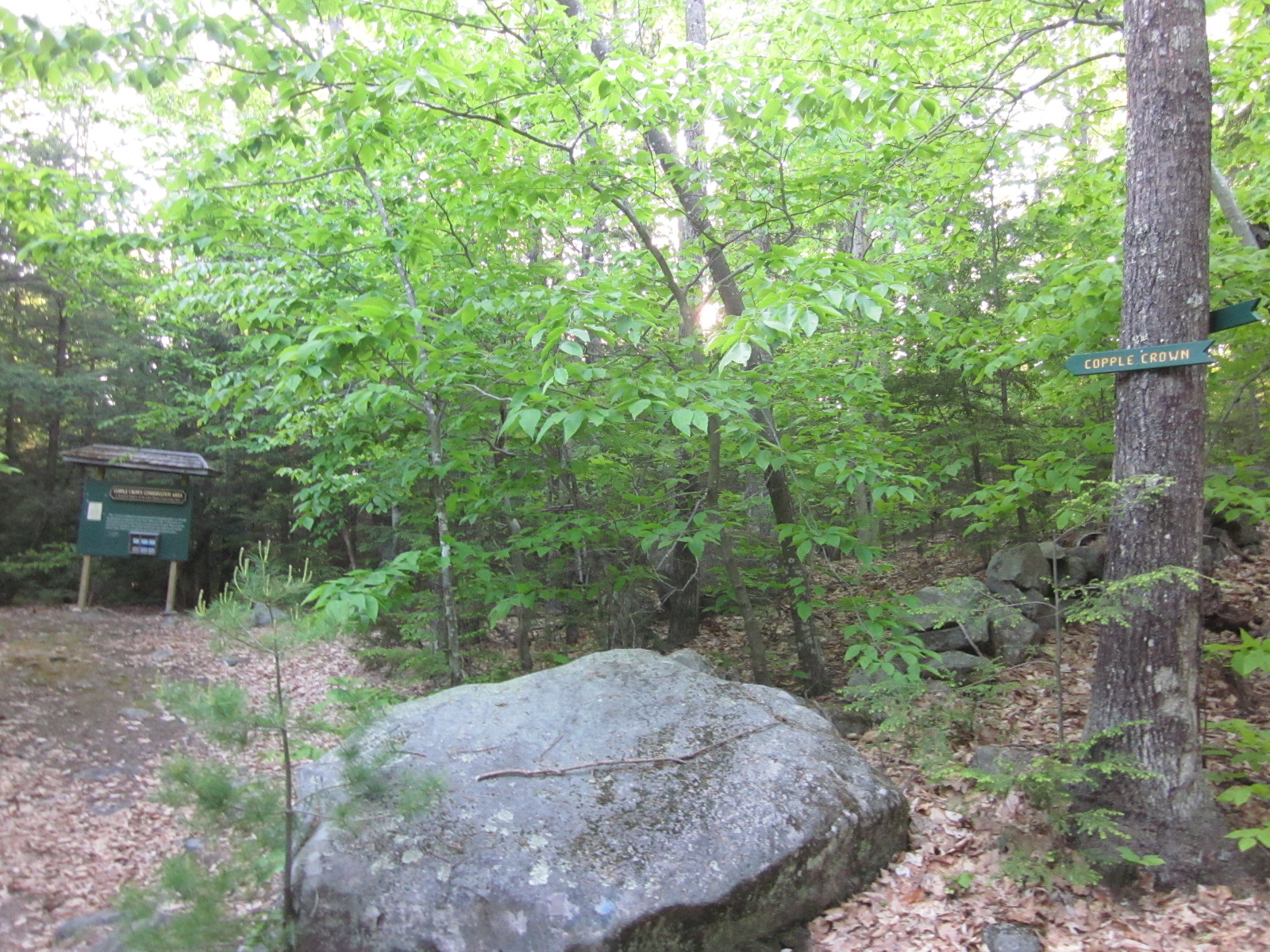
I followed the initial signs, which were helpful.

And then everything went to shit. Following this account, it sounded like the hiker who wrote it went up one of the side paths on the left and it was a mistake. She/He learned from their mistake and continued hiking down the main road (the right here), until they saw a kiosk announcing the start of the actual trail on the left.

Here's the problem- I didn't research this hike enough. Much like with a lot of lesser known hikes, I wasn't able to find much more than these 2 accounts, and the most recent one was 3 years old. I got quite hung up on the writer's phrasing: "I kept going past a prominent ascending logging road on the left, continuing down the old road until I saw a kiosk on my left" and "I followed it for awhile longer, before seeing a flat, grassy road depart to the left. I followed this and saw some blazes!"
To someone who has never been here, this told me that I would see a kiosk(?) of some sort to my left, and that I should ignore the "prominent ascending logging road on the left" and continue "for awhile longer" to get there.
So, yes- I didn't follow the road until I saw a kiosk. Instead, I went up at least 4 of the turns to the left, coming back down in fury when there was no kiosk. The term "awhile" made me think that the trailhead would start in just a bit. Unfortunately, the logging road I was following had probably 8-10 side roads/trails, all going off to the left, and I had no idea if the kiosk was gone, or if it was hiding right around the corner on any of these. I went up a few of them, trying to figure out if somehow I was supposed to go up this one or that one. Meanwhile the road just kept going for what seemed like forever. I didn't realize that the trailhead was OVER A MILE from the parking lot.
I found this out after I was near giving up, swearing, losing my mind at the bugs attacking me, exhausting from hiking up and down in confusion looking for a goddamn trailhead. I finally searched on my phone, and whether google just worked differently on my phone, or it was a case of me searching for "copple crown mountain" instead of just "copple crown," I found another website that was incredibly helpful- a site I'd been to before but had forgotten about, hikenewengland.com. Their account was not only much better detailed and accurate, but it told me exact mileage, and I was horrified to find out that I had to walk 1.2 miles to even get to the start of the mile and a half climb. Awesome.
Lesson learned. Search every combination of words you can think of- just when you think there's no info, maybe you just need to add a word to the search. Get different accounts from different sites, and follow several. And most importantly, use Franklin Sites as one of many references, not a guide. It's just personal accounts that are usually not very detailed, often incorrect, and usually dated. I was cursing that site and whoever wrote that account for my entire walk to the trailhead. I was cursing whoever maintained this trail- how do you have 2 signs within the first .1 mile, and then absolutely nothing saying HEY BY THE WAY, IT'S A FULL MILE IN THIS DIRECTION BEFORE THE TRAIL STARTS. OH, AND IGNORE EVERY SINGLE TURNOFF. But in the end, I guess I have to take some of the blame. Live and learn.
Now that I had even less time before dark and even less energy, I continued on the road for AWHILE and got to the trailhead. I ignored every single side road until I saw a sign marking it, sarcastically sighing that I was just starting my journey now.
From here, the hilarious thing is, the trail is marked to an absurd level. At times, it had to be- like when the "trail" looked like this:

Other times, it didn't need anything, but there were signs like crazy, like here:

In fact, there were several of these going up a switchback on a fairly steep section. Once I got over hating the signage ("HOW COME THERE WAS NOTHING FOR THE FIRST MILE!?"), I grew to absolutely love this. It was nice knowing exactly where I was going. This was a boy scout project I guess, and the guy who did it did a great job- he just neglected the first mile.
The hike was ok- it started out pretty boring and messy, but once it started gaining elevation, the switchbacks not only helped a lot, but made the trail very interesting and mountain-like. I would have enjoyed it more, but I was already exhausted, emotionally spent, and lower on water than I had hoped. But it sure was neat up there.
This is definitely a barely-hiked mountain, and it was cool seeing tons of vegetation growing all over the trail, leaves everywhere, etc.

I finally got to pretty much the top, and was met with this sign, which again, I absolutely love seeing.

Then I ran into this guy:


I hadn't been that close to a porcupine before (at least outside of a car), and after the initial heart sink of "what is that on the trail ahead of me?!" I ran after him cautiously to try to get pictures. He scampered up a tree and stayed up there, terrified of me. He was pretty rad.
I went to the summit first, and the hike up was brief and pretty awesome.

Coming up to the summit was a great feeling, as I could see the trail just stopping, with blinding light behind it.

Seriously, blinding.

I angled my camera and took some HDR shots to try and bring out the darker values of the view, but it was hard to look at, as there were pretty much zero clouds in the sky and the sun was slapping me in the face. Bugs were pretty bad too, but, as with all mountain tops, it was still pretty nice.

Here's an HDR of the right side of my view, which I believe is the northern top of Winnipesaukee:

and here was the best HDR I could get looking directly into the sun:

Fairly gorgeous, and definitely a lot nicer than a mall.
I then hiked back down to the sign and took the brief jaunt over to the East Peak. It was all downhill, next to a huge cliff. At one point, a deer busted through the trees in front of me, briefly stopping my already failing heart again.
I started to see the East Peak view, and was instantly happy. I also saw this in the rocks, which I always love:

And I did just that.

This view felt lower and less grand, but the lack of blinding sun in my face and a cool breeze kicking in made it perfect after a frustrating hike. It was so green.


This was a fully exposed cliff just above the trees, and I couldn't see a single sign of civilization anywhere. I couldn't spend much time up there because the sun was already going down fast and I had almost 3 miles to hike to get back to my car, but I tried to take it in for all it was in the time I had. I took a bunch of pictures, ate my granola bar, and saluted the world around me.

Here's a lovely HDR showing a lot more color than there actually was, but it felt this beautiful.

I hiked down the trail incredibly/frighteningly fast, nearly twisting my ankle a few times. I made it back to the trailhead before I needed any light, and thank god I finally learned my lesson after hiking last year without any type of light. I put my headlamp on, turned the music off (it was terrifying out there), and walked as fast as I could to get out of there.
It's easy to see why Copple Crown isn't that well known, but other than the initial garbage, it was a pretty nice hike. Once I hit the steep stuff, the trail was great and I got 2 completely different views looking at a view I usually only see from the other side (the Belknap range). It was solid work and a solid top of mountain experience, it just really really sucked having to hike a mile up a dirt road and another half mile of messy trail to get there.
So, while this wasn't quite the "one year ago, I left my job and began a new life and today I ring in the anniversary from the top of a mountain" experience I wanted, I've learned that things often don't work out the way you want them to, and to make the best of it. I still got my views, conquered another mountain, hung out with a porcupine, and have written what is a bloated but hopefully helpful semi-guide to Copple Crown that will hopefully help someone else in the future.
The hike hurt, I got bit by lots of bugs and I finished in the dark, but I have definitely turned into a hiking machine, and standing there with beautiful music in my ears and a beautiful view in front of me, completely alone for miles- this was definitely a perfect way to celebrate leaving my stressful job in a mall, surrounded by obnoxious customers and miserable people. Yay me.

Hike Time: Too long
Mileage: 5.6 according to hikenewengland, but I did over 6 from getting lost
Elevation gain: 1100 feet
Music listened to: I don't remember other than PMtoday- "In Medias Res," which was excellent.
currently listening to: 65daysofstatic- "Heavy Sky"
"but told myself to shut up, suck it up" ATTA BOY!!! Two roads diverged in a yellow wood....and you looked for the kiosk.
ReplyDeletekeep getting intense like this....I FUCKING LOVE IT>
haha hell yea dude. wait till you read my post about my 8 miler the other day. I had to dig deep and fight through several Jerrys.
ReplyDeleteit's weird- I have still yet to bike and I honestly don't really care (yet). I'm very into hiking all of a sudden and all I want to do is conquer mountains.